Circuit des étangs de Languidou
 Foot
Foot
 03h10
03h10
 Easy
Easy
 9,5 km


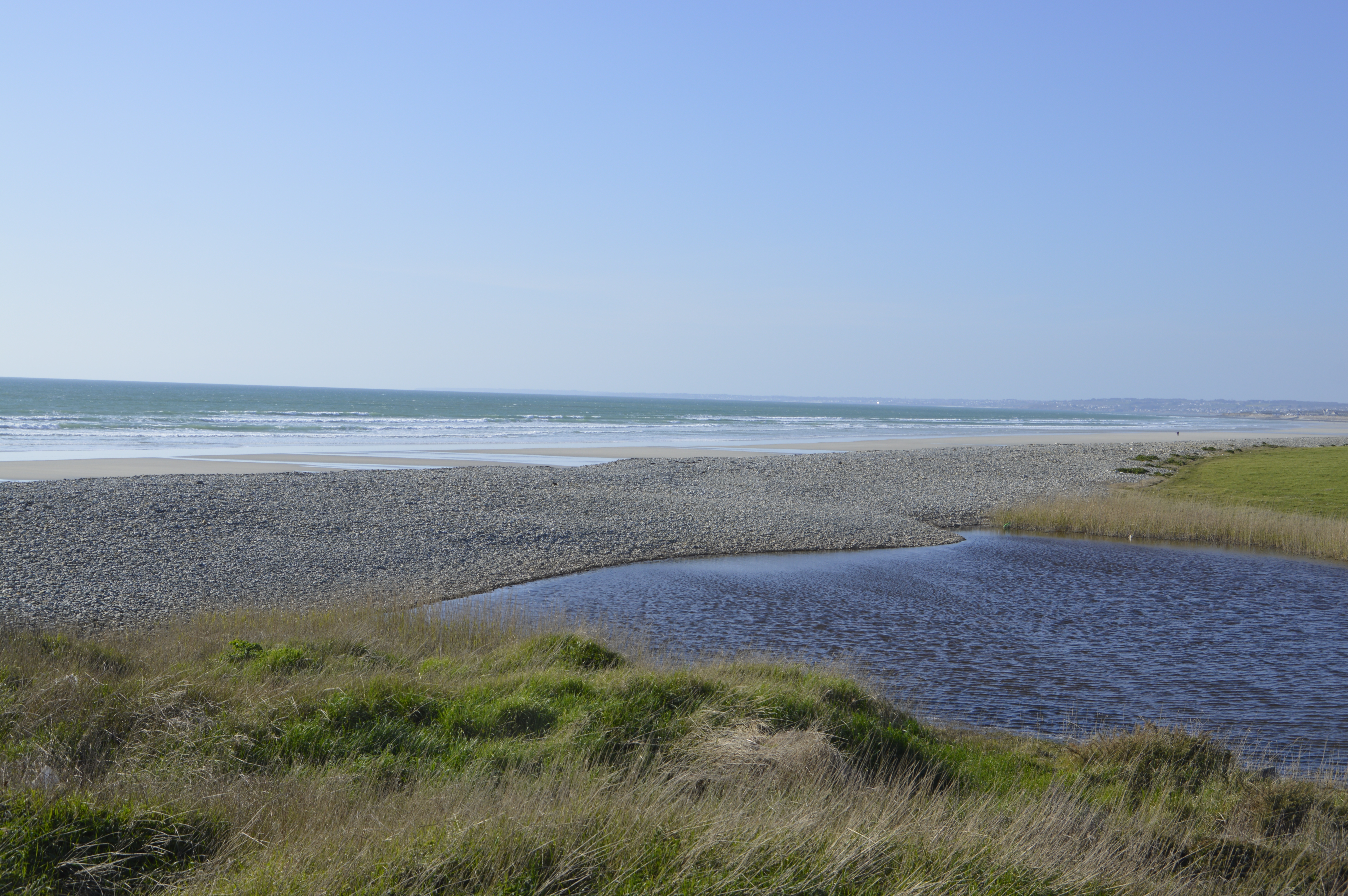
This pleasant walk allows you to discover the flora and fauna of the seaside and ponds. This trail will delight lovers of wetlands and wildlife as well as heritage enthusiasts. Along the way, you'll discover the marvellous Languidou ruins, as well as the church and calvary in the village of Plovan. Don't forget your binoculars to observe the wildlife of the Kergalan and Trunvel ponds. Start/Finish point: church car park in the village of Plovan. Difference in altitude: 73.73 Direction of route: anticlockwise Signposts: yellow PR and white-red GR® 34 Markings on the ground always take precedence over paper or digital documents. Practical information : Toilet at the church car park in the village of Plovan Play area and picnic area next to the church Advice before setting off: Take something to eat (drinks, snacks). Remember to take a bag for your rubbish. Don't forget your binoculars! Notice to walkers: In order to respect the integrity of the natural environment you are crossing, it is essential to attach rubber tips to the ends of your walking sticks. Repeated use of unprotected walking sticks by walkers can, in the medium term, have irreversible consequences, such as stripping the soil and vegetation, gullying and widening the path's right-of-way. Variant to be used in wet winters, between Ty Palud and Trunvel, via Kéramoine and Penn Ar Prat. Dogs welcome The trail runs through sensitive natural areas protected by the Conservatoire du Littoral, and dogs must be kept on a lead throughout the walk. Be careful not to take your dog onto the beach during the restricted periods (1 May to 30 September). To view the variants and the route in detail, we recommend that you download an application that reads GPX files (openrunner, gpx viewer or any other application that reads gpx files of your choice).
Points of interest
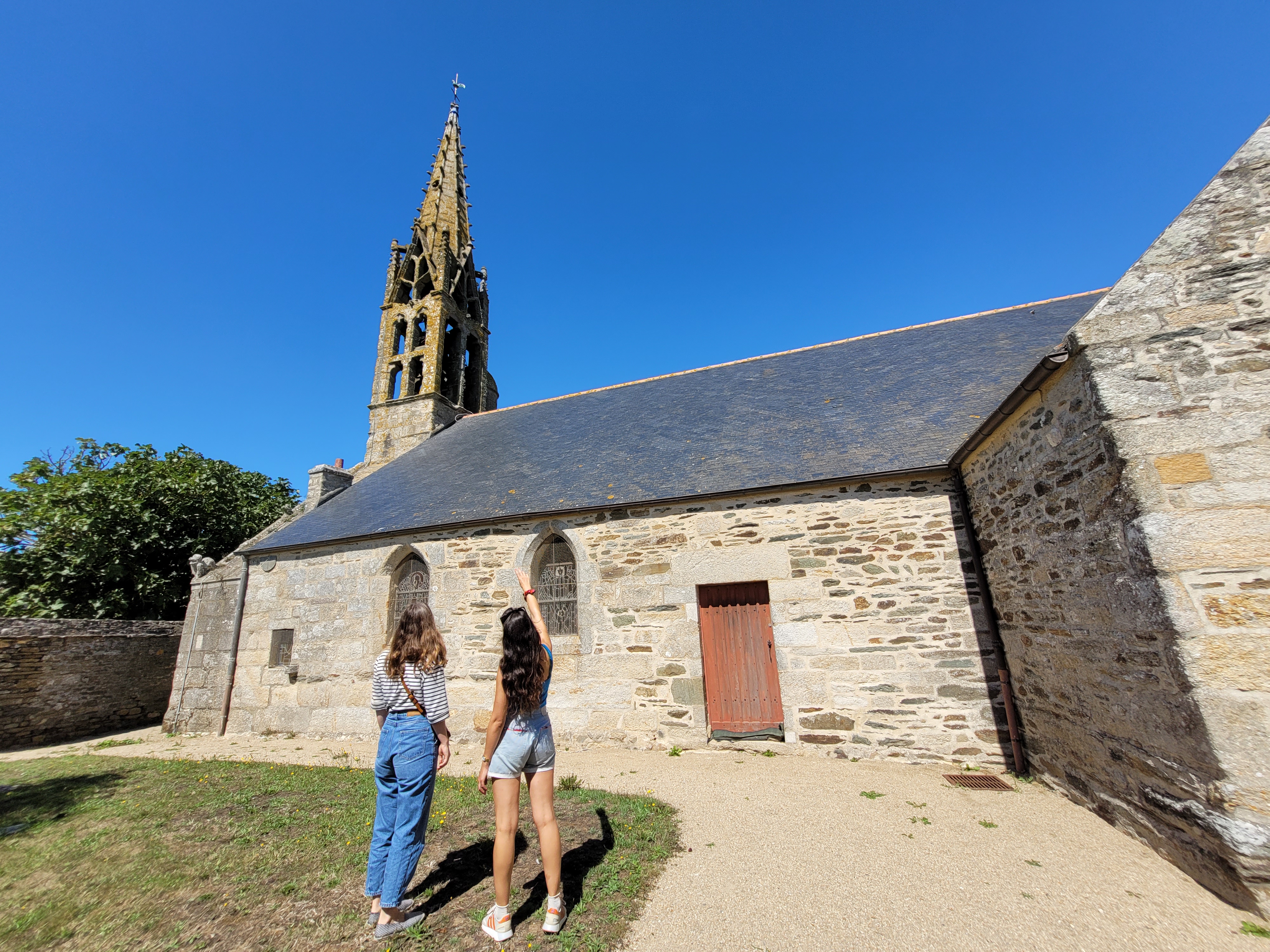
1 Eglise de Plovan
Malgré le peu de sources indiquant la construction de cette église, de nombreux éléments significatifs la rattachent au style architectural de Pont-Croix, la datant probablement de la fin du XIIIè siècle. Elle a été largement reconstruite en 1791, et le clocher, lui, date de 1520. L'église abrite encore de nombreuses statues transférées depuis la chapelle de Languidou à la fin du XVIIIè siècle.
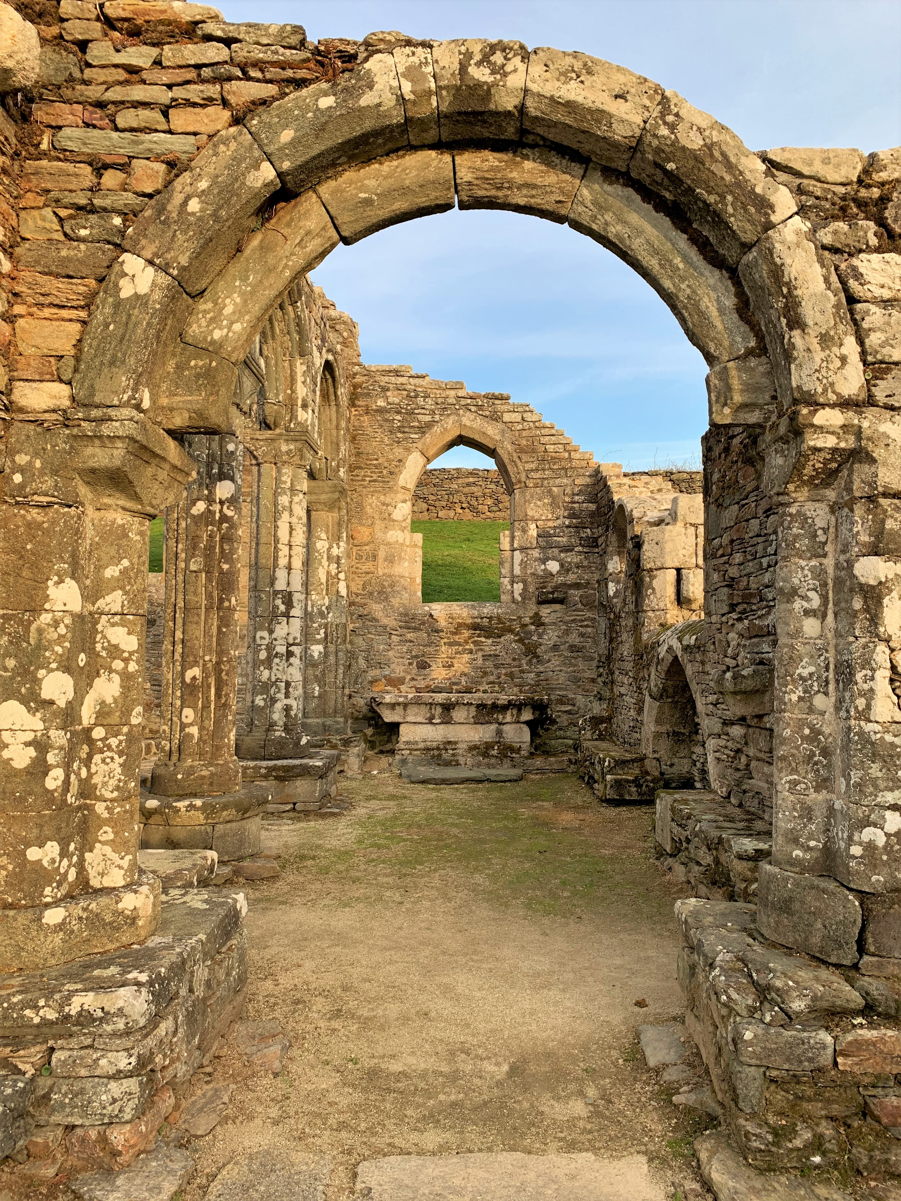
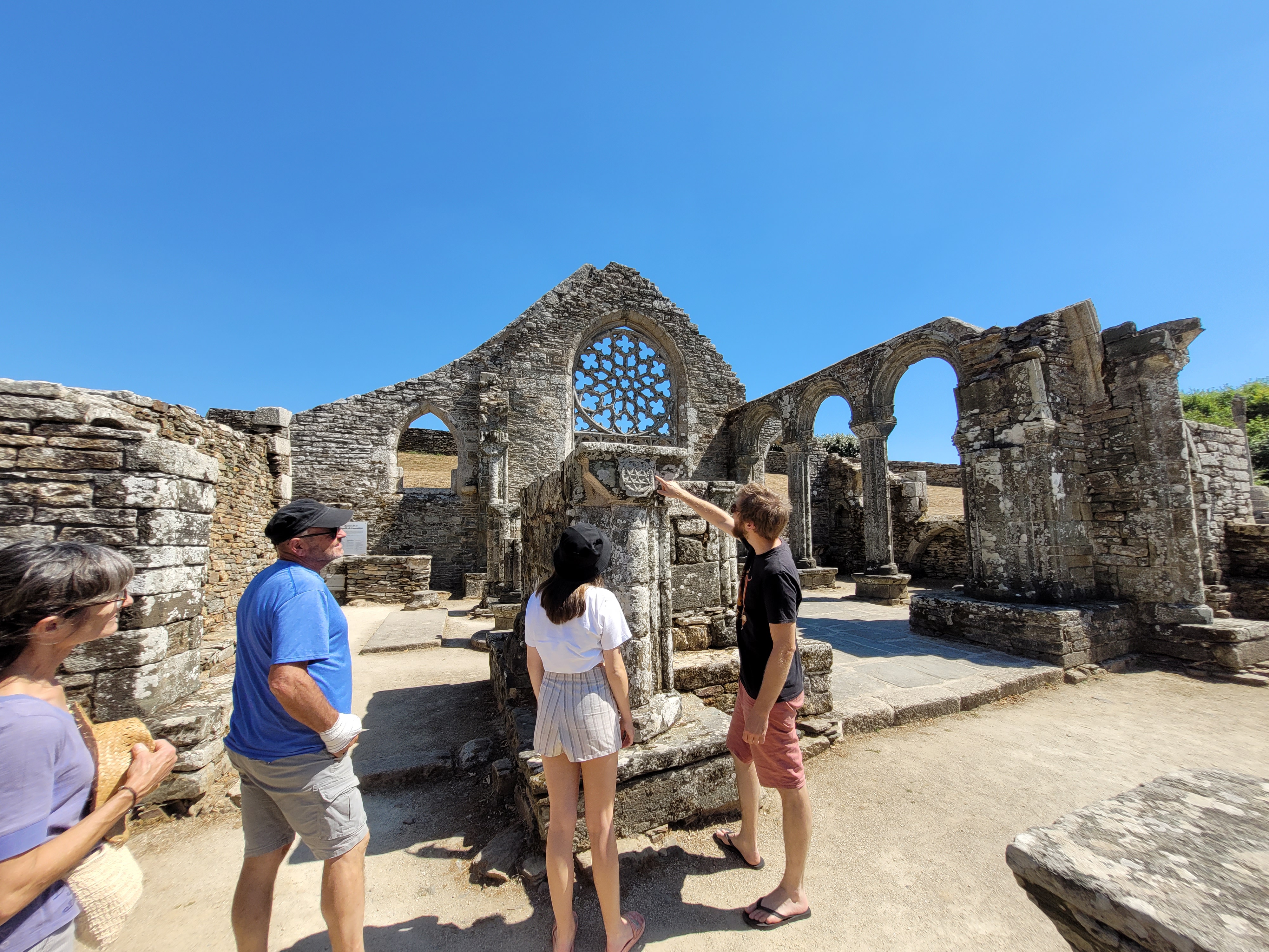
2 Ruines de languidou
Aujourd'hui en ruines, cette chapelle du milieu du XIIIe siècle conserve charme et beauté. Elle a en outre sa place dans l'histoire de l'art, car elle est peut-être l'édifice fondateur du style architectural dit de l'École de Pont-Croix. Elle se trouve en rivalité pour ce titre avec la collégiale Notre-Dame de Roscudon, à Pont-Croix : du fait de l'impossibilité de les dater avec une précision suffisante, on ne peut savoir lequel des deux édifices est le prototype du style.
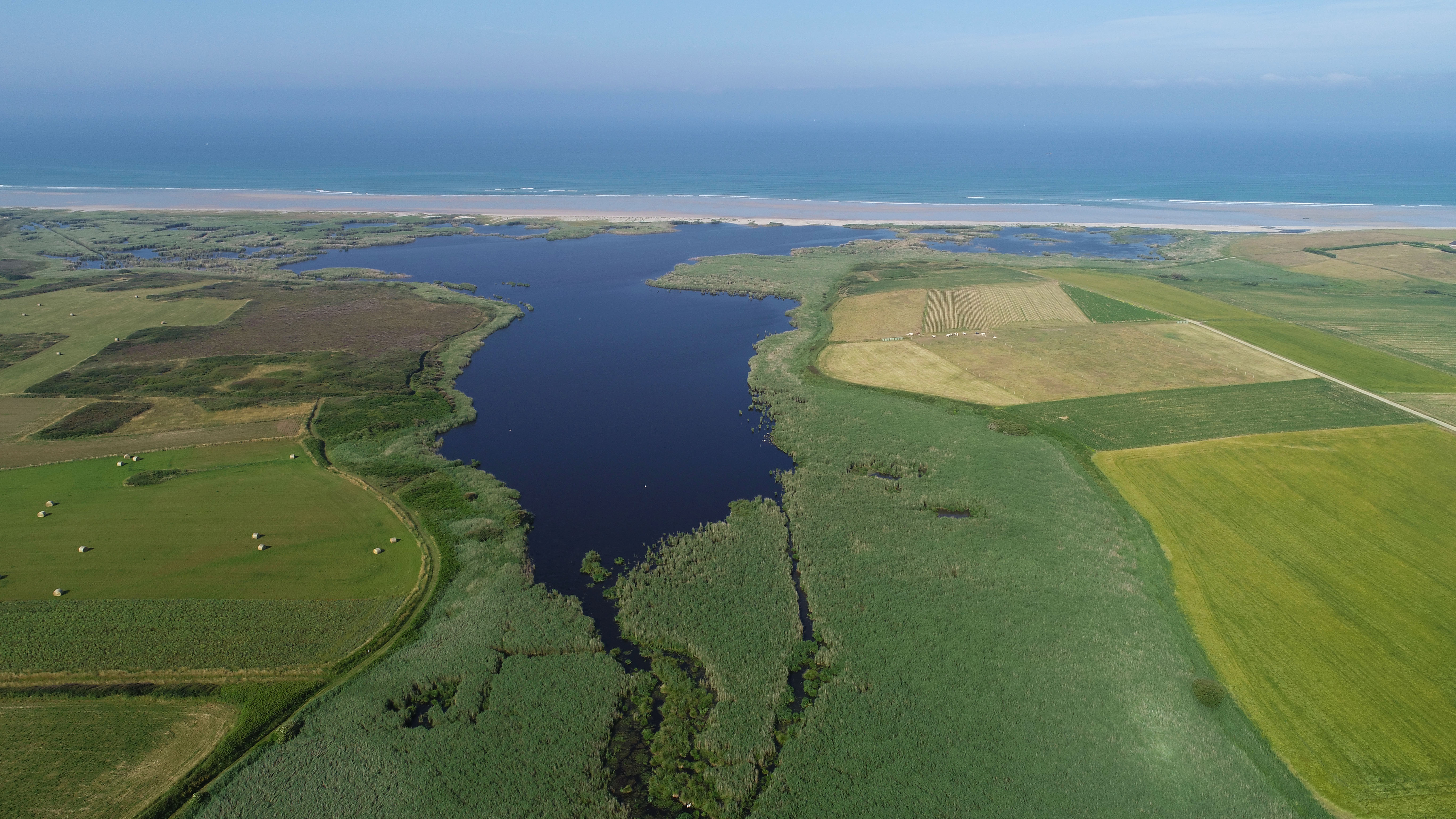
3 Etang de kergalan
Vous pouvez y observer une faune remarquable (en particulier les oiseaux : gravelot à collier interrompu, butor étoilé, phragmite aquatique..., et aussi des anguilles et des loutres) et de la flore (utriculaire, fétuque bigoudène...) qui caractérisent cette zone humide.
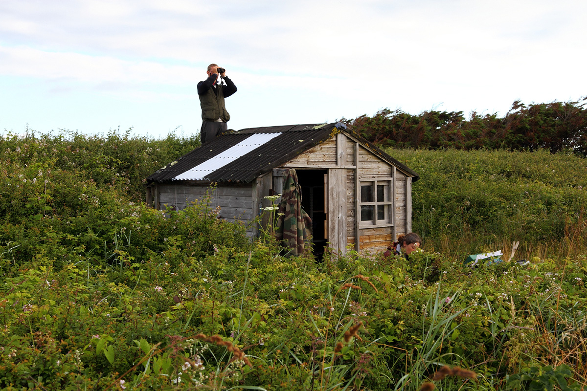
4 Observatoire de Trunvel
Phragmites des joncs ou aquatiques, martins-pêcheurs, ou pouillots véloces ....
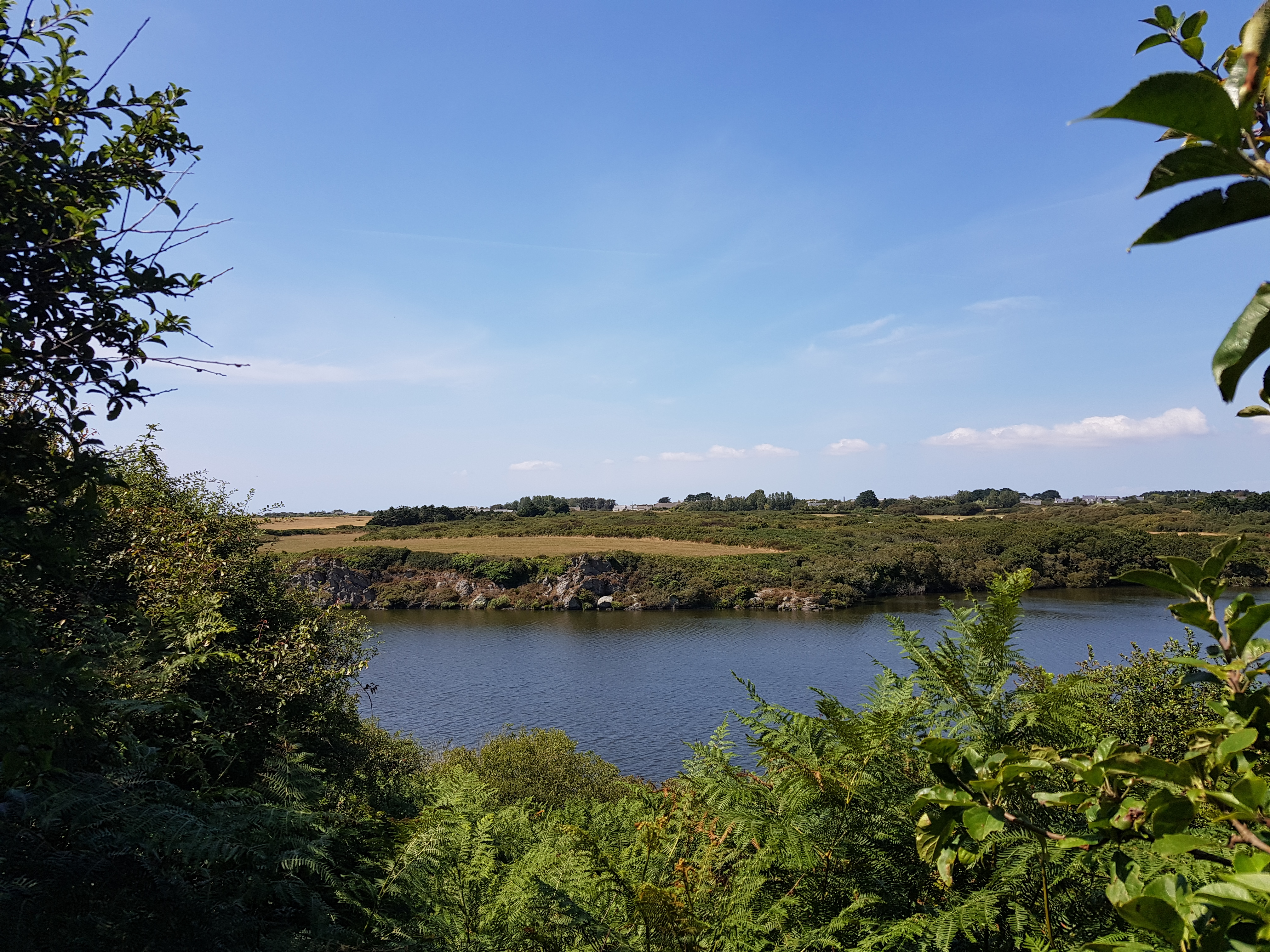
5 Etang de Trunvel
L'étang de Trunvel est le plus connu de la Baie d'Audierne. Il est reconnu d'importance internationale pour la migration des fauvettes des marais, attirées par l'étendue des roselières. N'hésitez pas à visiter la station de baguage sur le site
Practical information
Address of departure
Place de St Gorgon 29720 PlovanDowloads
GPX / KML files allow you to export the route of your walk to your GPS (or other navigation tool)