La chapelle Saint-Laurent - Saint-Coulitz
 Foot
Foot
 03h00
03h00
 Easy
Easy
 10 km
10 km
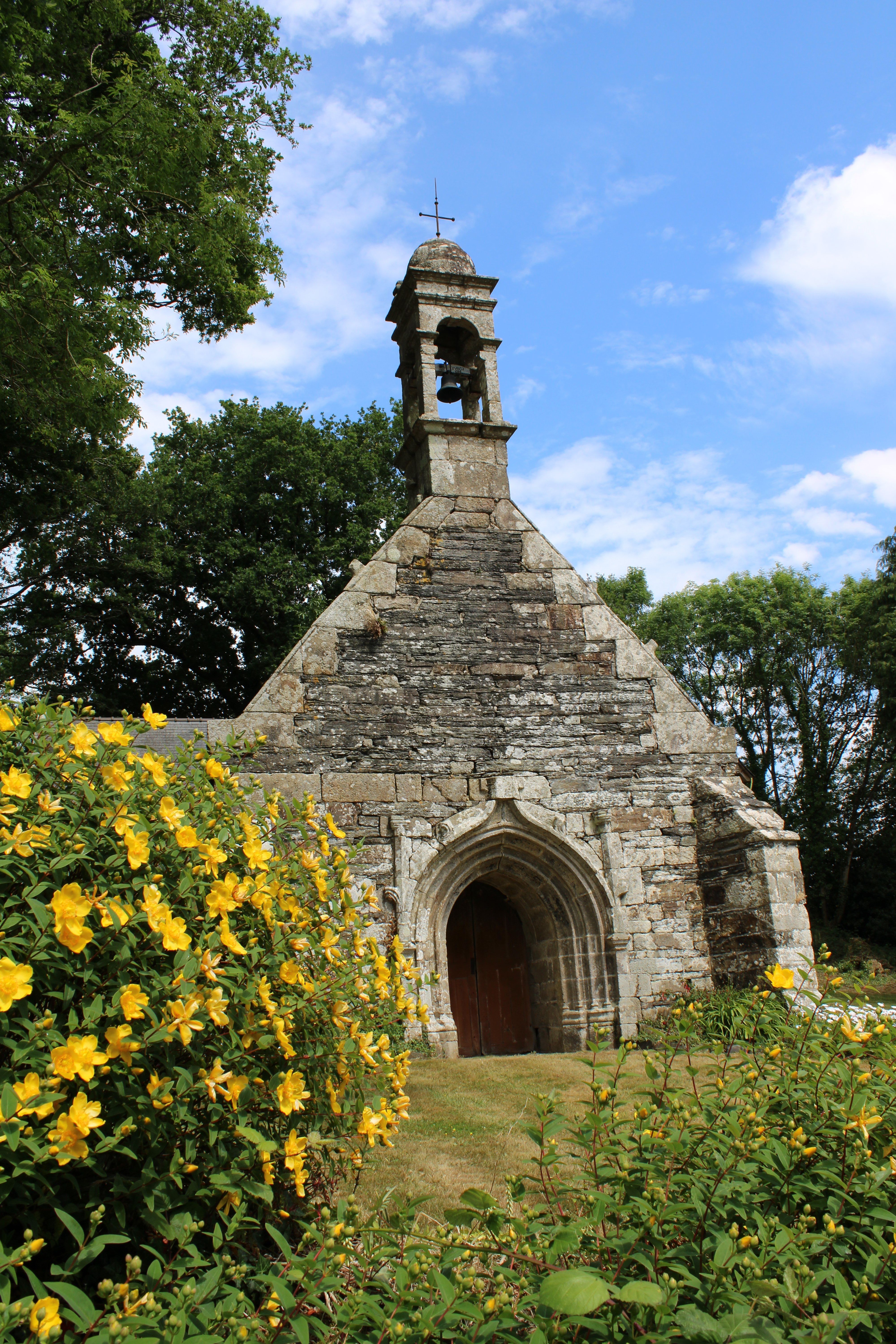

Set off on this relatively easy hike to discover a rich heritage of rivers, churches and magnificent landscapes of undergrowth and twists and turns of the Aulne! The starting point for this walk, called "La chapelle Saint-Laurent", is the town hall car park in Saint-Coulitz, from where this 10km route begins. To start, take three right-hand bends around the centre of Saint-Coulitz. Then turn left onto the main road for 800 metres. At the Guivin crossroads, turn left towards Troboa, watching out for the wind turbines. When you reach the charming little Troboa cross, turn left and continue straight on until you reach the chapel of Saint-Laurent, also known as "Troboa". Once you've discovered the chapel, retrace your steps for 40 metres, then take the path leading to the fountain. This construction is remarkable for its use of local slate, with no mortar used. Then walk down this sunken path through the undergrowth to the counter-harbour of the Nantes-Brest canal. This will take you along the River Aulne for 4.3 km, past the Prat Hir locks and then the Toul ar Rodo lock. At the Toul ar Rodo lock, turn left up a path through undergrowth. Return along the Pennagour road. When you reach the village, take time to admire the church before returning to the town hall car park, the final stop on this pleasant walk.
Points of interest
Practical information
Address of departure
19 Place François Mitterrand 29150 Saint-CoulitzDowloads
GPX / KML files allow you to export the route of your walk to your GPS (or other navigation tool)